Small Batch Maps
Your data has a geography. I make it visible.
From raw spatial data to interactive maps — pipelines, analysis, and cartography.
Navigate to contact sectionYour data has a geography. I make it visible.
From raw spatial data to interactive maps — pipelines, analysis, and cartography.
Navigate to contact sectionGeospatial tools I'm building with open source and AI-assisted workflows.
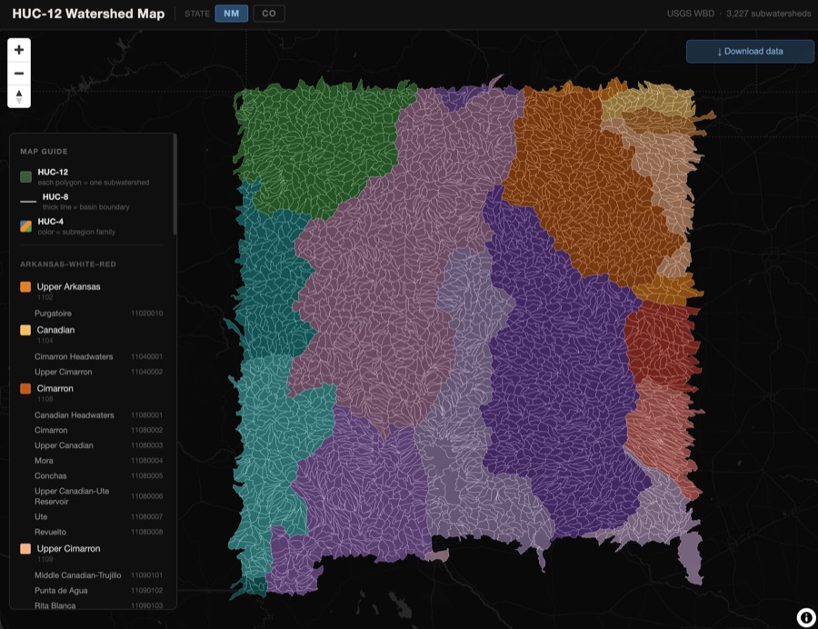
Per-state pipeline that fetches USGS HUC-12 subwatershed boundaries and renders them as publication-quality static maps and a PMTiles-powered interactive web map. One command exports GeoJSON, GeoParquet, GeoPackage, PMTiles, PNG, and PDF.
Python · GeoPandas · Tippecanoe · PMTiles · MapLibre GL JS
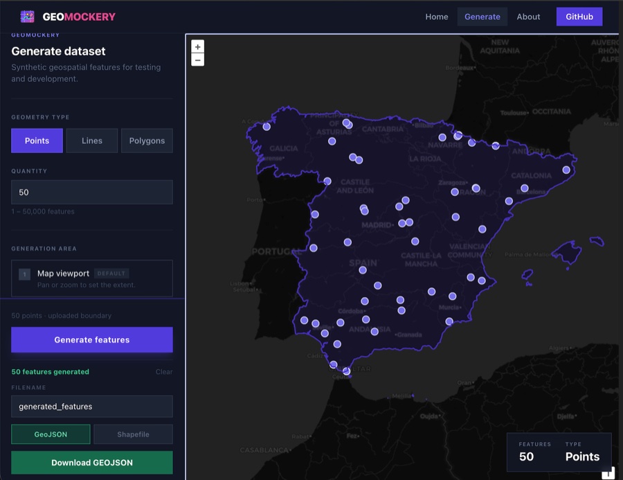
Generate synthetic GeoJSON and Shapefile data in the browser. Draw a boundary, configure geometry types and rule-driven attributes, export. No server, no signup.
Next.js · OpenLayers · Turf.js
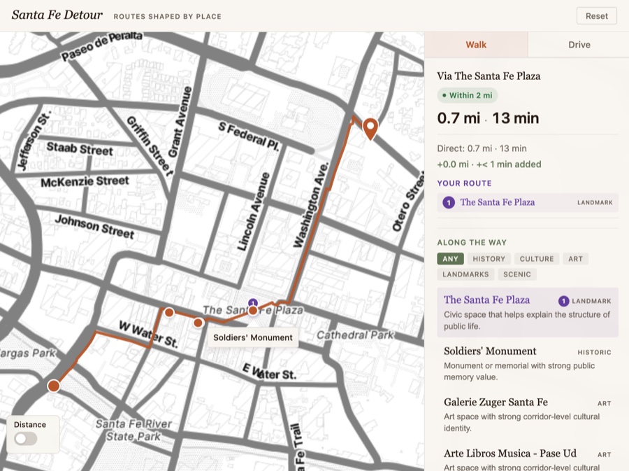
Calculates optimal paths then uses network-aware analysis to score nearby detour stops — historic sites, food, scenic overlooks — by exact time and distance cost.
React · FastAPI · MapLibre GL JS · OpenRouteService
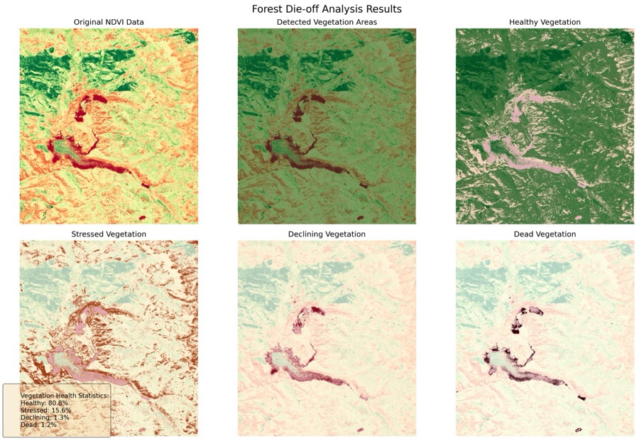
NDVI change analysis for the East Troublesome Fire area, Colorado. Classifies Sentinel-2 imagery into vegetation health bins and surfaces results through a Streamlit interface, REST API, and H3 hexagonal aggregation.
Python · Rasterio · Streamlit · FastAPI · H3 · GEE
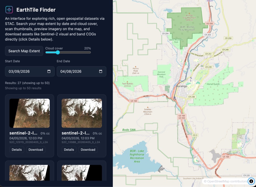
STAC API browser for satellite imagery. Search Sentinel-2 scenes by map extent, date, and cloud cover — preview footprints, scan thumbnails, download COGs.
React · MapLibre GL JS · STAC API · Zustand
I'm a geographer and cartographer from Durango, Colorado. I'm now based in Santa Fe, New Mexico, where I spend my off-hours practicing yoga and trail running in the Sangre de Cristo Range.
I finished my PhD in Geography at UW–Madison in 2014, where my research focused on web mapping with emerging open web standards and open source tooling. From there I designed, built, and taught the graduate-level digital mapping curriculum for New Maps Plus — an award-winning program whose students have taken home four NACIS student dynamic map competition wins.
I stepped away from academia in 2024 to explore what these tools could do in industry, government, and the nonprofit sector. That curiosity is still what drives the work.
Conservation teams, nonprofits, and research groups hire me when they have a spatial data problem and no in-house GIS developer.
Python · GeoPandas · PostGIS · DuckDB · FastAPI · PDAL · GDAL/OGR
QGIS · LiDAR & Thermal · Rasterio · Shapely · Tippecanoe · PMTiles
MapLibre GL JS · HTML/CSS/JS · Vite + React · D3.js
I'm open to project work, collaborations, or just a good conversation about maps.