Small Batch Maps
Bespoke GIS Tools and AI-Enhanced Cartography
Navigate to services section to learn about our offeringsBespoke GIS Tools and AI-Enhanced Cartography
Navigate to services section to learn about our offeringsAI-enhanced spatial workflows, guided by care & domain expertise
I don't just clean data—I interrogate it. With Python, geopandas, and a healthy skepticism for null-filled shapefiles, I build workflows that turn chaos into clarity. Pattern-finding, truth-surfacing, and no black boxes allowed.
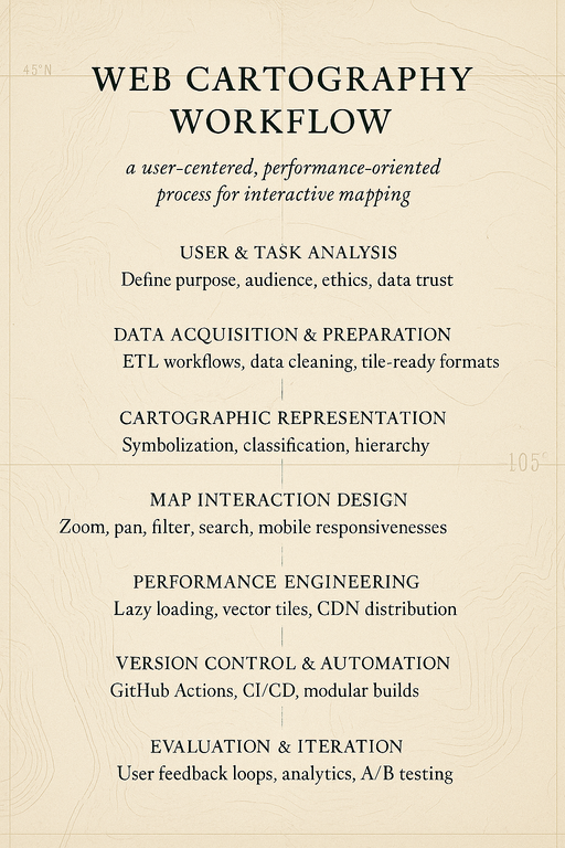
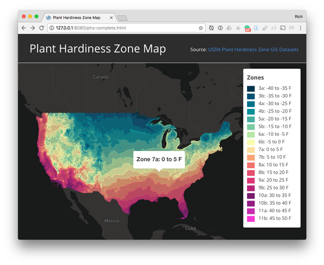
Expand to see detailed information about geospatial data science servicesA good map doesn't just inform—it moves. I design web maps and spatial dashboards that load fast, look sharp, and do their damn job. From climate stories to conservation tools, every pixel has a purpose.
Expand to see detailed information about web cartography servicesI fold large language models and intelligent agents into GIS workflows without losing the plot. Think: faster code, automated insights, and spatial systems that scale—without surrendering to snake oil or one-click magic.
Expand to see detailed information about AI-assisted workflow services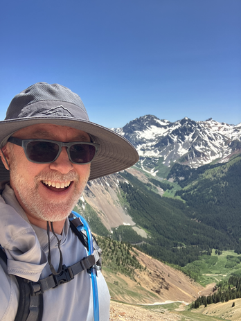
With a Ph.D. in Geography, GIS, and Cartography, I specialize in transforming complex geospatial data into meaningful insights and beautiful, functional maps. My approach combines traditional cartographic principles with modern web technologies and current AI-assisted workflows.
I believe in ethical data practices and human-centered design. Every project is treated as a unique challenge, deserving custom solutions rather than cookie-cutter approaches. Whether you need sophisticated spatial analysis, interactive web applications, or AI-assisted workflows, I bring both technical expertise and creative vision to your geospatial challenges.
Born and raised in Durango, CO, I enjoy the outdoors, hiking, and skiing.
Postdoctoral Scholar & Assistant Professor 2014 – 2024
Founded curriculum development for 9-course online graduate program in Digital Mapping after earning PhD at UW–Madison
Mentored 30+ MS students and 50+ certificate students with graduates placed at USGS, Cornell, and The New York Times
Award-winning pedagogy supervising student projects that won national awards (NACIS, CaGIS) for cartographic design
Curriculum spanning web mapping, geospatial analysis, UX design, and open-source development
Championed reproducible research using Jupyter Notebooks and version-controlled workflows
Geospatial Consultant 2015 – 2020
Developed interactive dashboards supporting internal decision-making during disease outbreaks
Designed public-facing and internal tools clarifying complex data for decision-makers
Built network mapping prototypes visualizing pathogen research and connections between health programs
Peer-reviewed publication focused on a decision-support tool for disease outbreak response
Cross-functional collaboration with epidemiologists, data scientists, and developers bridging complexity and clarity
Explore my applications of geospatial data science and web cartography. And please get in touch if you'd like to discuss a project.
Research framework for watershed delineation accuracy and systematic comparison of hydrological analysis tools
AI-powered geospatial data generator for creating realistic mock location data for testing and development
AI-powered forest recovery monitoring using satellite imagery and computer vision after wildfire events
Modern web framework for exploratory spatial data analysis with advanced mapping and statistical capabilities
Python tool for processing Digital Elevation Models to g
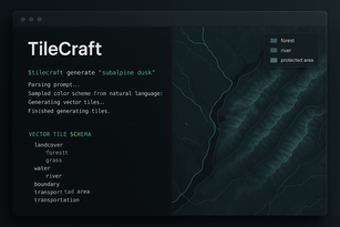
AI-assisted CLI tool for generating context-aware vector tile styles from OpenStreetMap datadriven by natural language input
I typically respond within 24 hours. Most projects start with a free discovery call—to find the signal in the noise and chart a direction together.
Whether you're mapping recovery networks, building smarter dashboards, or just want to talk shop about spatial ethics—I'm all ears.